
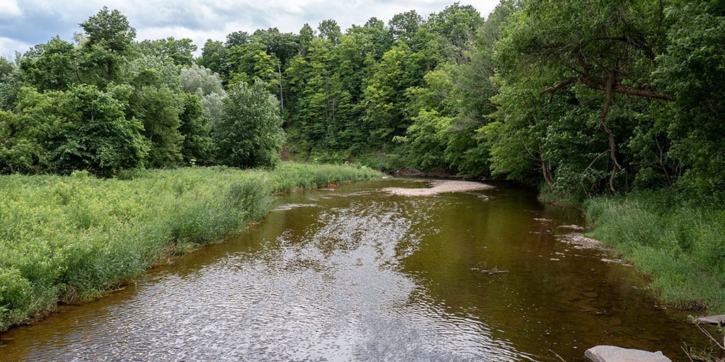
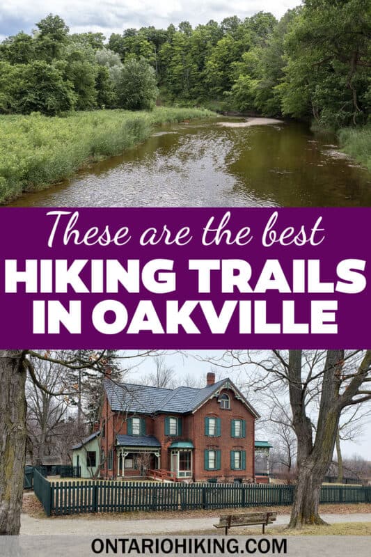
These are the best trails in Oakville if you’re looking to go for a hike or a walk around town. You’ll surely love these scenic hiking trails in Oakville as these are the top spots to experience nature. You don’t need to venture far outside of Oakville to go for a wonderful walk or hike. If you don’t mind going a short distance away, check out these Burlington hiking trails, hikes in Halton Hills, and Milton hiking trails.
Posts may be sponsored. Post contains affiliate links. I may be compensated if you make a purchase using my link.
While some of these trails in Oakville exist within the grounds of a provincial park, most of them are community walking trails and hiking trails. Some of them will make you feel like you’re nowhere near Oakville, but off in nature somewhere else. Some of them will have neighbourhood vibes as the path runs behind homes and communities.
Here are the best hiking trails and walking trails in Oakville that we highly recommend checking out. Bronte Creek Provincial Park and Sixteen Mile Creek Trail are worth the drive if you’re coming from a neighbouring city or town. The others are perfect if you’re already in Oakville and looking for somewhere to go for a walk.
Join the Ontario Hiking Facebook Group
You are also welcome to join our Ontario Hiking Facebook Group – it’s a great way to ask questions about hiking in Ontario, share your Ontario hikes, and get inspired!
Come Hiking With Us! Join an Upcoming Group Hike or Tour!
We are so excited to have group hiking adventures within Ontario and beyond. Learn more about how you can join us for a group hiking trip.

Hiking Trails in Oakville: Bronte Creek Provincial Park

Bronte Creek Provincial Park is an excellent place to explore, and you’ll likely have to visit at least a couple of times to see it all. It’s a popular spot for hiking, camping, and even disc golf. The trails are divided by the Bronte Creek, with the majority of them being on the south side of the creek. There are more trails north of the creek as well.

There are multiple parking areas that get you closer to the various trails, depending on where you’re looking to walk. For the most part, the trails are flat and easy to walk. Here’s a listing of the trails, though you should check out our guide to Bronte Creek Provincial Park if you’re looking to plan a visit.

The hiking trails at Bronte Creek Provincial Park: the Lookout Ravine Trail, Trillium Trail, Half Moon Valley Trail, Logging Trail, Maiden’s Blush Trail, Barrier Free Trail, Bronte Creek Trail, Gateway Trail, Field and Forest Trail, and the leash free trails for dogs.

There are lots of events at Bronte Creek Provincial Park each season. In March, you can visit for the annual maple syrup festival. In August, there are guided Ghost Walks where you might experience some paranormal activity at the 1899 Spruce Lane Farmhouse. These trails are among the most haunted hiking trails in Ontario.

The annual Harvest Festival happens at the end of September with pumpkin picking and carving, farm house tours, wagon rides, and yummy treats. And the Victorian Christmas event will allow you to step back in time to 1900 to experience a vintage holiday celebration at the Spruce Lane Farmhouse.
Best Trails in Oakville: Sixteen Mile Creek Trail

Sixteen Mile Creek Trail is right in the middle of town, and it’s a beautiful trail tucked behind residential communities. While at some points you might hike past some homes, you’ll feel transported into nature for the most part. This is my favourite trail in Oakville, hands down.

Also known as the Sixteen Mile Creek Heritage Trail, it’s a loop trail that’s about 6km and it crosses both sides of the creek. It’s mostly a paved path that’s pretty easy for all skill levels. There are some sections that travel up and down large hills, but it’s nothing that’s unmanageable.

Once you cross the river, you’ll end up hiking up the biggest incline on the trail. When you reach the top, there’s a small deck with a lookout point with amazing scenery of Sixteen Mile Creek from above.

One section of the Sixteen Mile Creek Trail is called the Moccasin Trail. These are part of the heritage trails in Oakville that explore this land from an Indigenous perspective. Overall, there are a series of 13 plaques that share Indigenous stories and provide a deeper understanding of Indigenous culture. There are two Moccasin Trails in Oakville, and you’ll find the other one at the Bronte Creek Heritage Trail.
Walking Trails in Oakville: Joshua’s Creek Trail

Joshua’s Creek Trail is divided into two sections in Oakville: the North Joshua Creek Trail and the South Joshua Creek Trail. So far, I’ve only explored the South Joshua’s Creek Trail, which starts in Arkendo Park and runs north to Brookmill Road (just past Ford Drive).

North Joshua’s Creek Trail starts at Dundas Street, west of Ninth Line, and travels south to the Parkway Park near the Crosstown Trail. These trails run alongside Joshua Creek, which flows through Oakville and down into Lake Ontario.

On the south side of Joshua’s Creek Trail, you can admire beautiful views of Lake Ontario from Arkendo Park. Then, you’ll walk on the trail through a section known as Joshua’s Valley Park.

It’s a very peaceful walking path and one of the best trails in Oakville. You’ll descend into the valley down a flight of stairs at one point, but the majority of the trail is pretty flat. You’ll be able to check out scenery of Joshua’s Creek from the trail and some little bridges on the way.


Joshua’s Creek Trail is one of the Oakville Heritage Trails, a network of paths that connects all parts of the community. The Bronte Creek Trails, Joshua’s Creek Trail, Sixteen Mile Creek Trail, the Waterfront Trail, and the Crosstown Trail make up the Oakville Heritage Trails.
Crosstown Trail
The Crosstown Trail is a four-metre wide paved multi-use trail in Oakville between Sixth Line and Neyagawa Blvd. The path is 2km in total and it connects the Nipigon Trail with the Sixteen Mile Creek Trail. This is one of the most popular trails in Oakville for biking, and it’s great for walking, too.
As it’s not one of the most scenic trails, I’d stick to Sixteen Mile Creek Trail or Bronte Creek Provincial Park if you’re looking to go for a hike. But, if you’re looking to take a longer walk, you can always hike at Sixteen Mile Creek and use the Crosstown Trail to explore more areas of Oakville.
Nipigon Trail Oakville

Nipigon Trail in Oakville is a 3.5km out and back path (less than 2km in one direction), mostly behind some houses and neighbourhoods. You can use this path if you live nearby and you’re looking to go for a more scenic walk. This trail is also great for cycling, too.


There’s an access point at Milbourne Crescent from the south side, and the trail ends at Oak Park on the north side. We really enjoyed this little walk, mostly for Oak Park itself. There’s a pond with ducks, a butterfly garden, and an off-leash dog park for those with pups.
Best Trails in Oakville: Shoreline Woods Loop
The Shoreline Woods Loop Trail is located at Iroquois Shoreline Woods Park. It’s 35 hectares in size, making it one of the biggest remaining upland woodlots below the Niagara Escarpment. This is a relatively wide trail that’s about 2km in total. If you’re looking for a gentle walk through the forest that won’t take too long, the Shoreline Woods Loop Trail is perfect.
Morrison Valley Trail
The Morrison Valley Trail is an Oakville trail just east of Trafalgar Road between Upper Middle Road and Dundas Street West. This is a scenic trail behind residential homes in the Morrison Valley and by the Morrison Creek. It’s a relatively secluded forested trail for walking or biking, and you might be able to spot some birds or other wildlife. It is about 3km out and back.
McCraney Creek Trail
The McCraney Creek Trail meanders along a waterway that flows into the Fourteen Mile Creek. The path runs between Dundas Street West and the Indian Ridge Trail at the QEW. There are multiple access points and two routes on either side of the creek.
Starting at the Indian Ridge Trail on the south side, you can walk on the west side of the McCraney Creek Trail. This connects with the Glen Abbey Trail. If you head west and then walk up Pilgrims Way, you can reconnect with the McCraney Creek Trail on its west side.
Conversely, you can walk on the east side of the McCraney Creek Trail from the Indian Ridge Trail. Venturing east on the Glen Abbey Trail, you’ll walk on a couple of streets and through Windrush Park to connect back with the east side of the McCraney Creek Trail.
Fourteen Mile Creek Trail
The Fourteen Mile Creek Trail starts at the Langtry Park Walk, near Third Line and the North Service Road. These trails in Oakville extend through the Fourteen Mile Creek Lands. It’s a 4.2km out and back trail that dead-ends at Stationmaster Lane.
On the north side of Upper Middle Road, a second section of the Fourteen Mile Creek Trail continues north. It ventures through West Oak Park and continues up through Cannon Ridge Park and north to Dundas Street West.
Taplow Creek Trail
Just east of the McCraney Creek Trail, you can walk on the Taplow Creek Trail, one of the best trails in Oakville. There’s a southern access point at Indian Ridge Trail and a northern access point at Upper Middle Road. You can make a loop of the Taplow Creek Trail by walking on both the east and west sides of the trail.
The Taplow Creek Trail runs through Nottinghill Park, and there are schools on both the southern and northern sides of the path. Both the Indian Ridge Trail and the Glen Abbey Trail connect the Taplow Creek Trail with the McCraney Creek Trail. The Taplow Creek runs directly into Lake Ontario, and it’s a pretty quiet and scenic walk to enjoy.
Walking Trails in Oakville: Waterfront Trail

The Waterfront Trail is one of the longest hiking trails in Ontario. It is a 3000km route along Lake Ontario, the St. Lawrence River, Lake Erie, Lake Huron, and Georgian Bay. It connects 155 communities, villages, and First Nations. The Waterfront Trail runs through four UNESCO World Biosphere Reserves, six national parks, 42 provincial parks, 83 conservation areas, and 520 waterfront parks.

The Waterfront Trail runs along the shores of Lake Ontario in Oakville, as well as connecting sections on Lakeshore Road. In Oakville, the Waterfront Trail brings you to two harbours, gardens, museums, on scenic streets and past lovely homes. You can find a full trail map of the Great Lakes Waterfront Trail on the official website.
Oakville Trails Map

Here is a map of the aforementioned walking trails in Oakville. The pins on the map are the access points and parking lots where you can start or end your journey.
For a more detailed view of these trails in Oakville, I suggest checking out the official Town of Oakville website map. Many of these trails are not located on AllTrails or any other app, so this is the most detailed view of the paths.
What to Bring on a Hike
A proper pair of hiking shoes is an absolute must. It’s also a good idea to bring sunscreen and lots of water, too. My water bottle of choice is the GRAYL Purifier because you can drink ANY water from any source, no matter what. Water from lakes, streams, rivers, public restrooms, you name it. It’s the world’s fastest portable purifier.
Don’t forget to pack some bug spray because there can be biting bugs depending on the time of year. Even if there aren’t any signs, it’s safe to assume that ticks are all over Ontario hiking trails. Protect yourself against ticks by reading our guide to avoiding ticks on the trails.
For amazing deals on hiking products like backpacks, boots, clothing, and gear, check out the Decathlon Canada shop!
More Hiking Trails in Halton Region
If you’re seeking more hiking trails beyond Oakville in Halton Region, we’ve got you covered! Here are some of the best trails in Halton:
- Kerncliff Park in Burlington
- Royal Botanical Gardens Bridle Loop Trail in Burlington
- Mount Nemo Conservation Area in Burlington
- Hilton Falls Conservation Area in Milton
- Crawford Lake Conservation Area in Milton
- Limehouse Conservation Area in Halton Hills
- Silver Creek Conservation Area in Halton Hills
- Scotsdale Farm in Halton Hills
| Follow Ontario Hiking on Social Media! Instagram | Facebook | Twitter | Pinterest | Newsletter | Join the Community |
Become an Ontario Hiking Supporter!
Join the Ontario Hiking Patreon and you’ll become a VIP member of the Ontario Hiking community! You’ll receive ad-free, downloadable hiking guides with new guides added weekly. Plus, there are many more perks! Become an Ontario Hiking Supporter today!


Check out the Ontario Hiking Shop!
Inspired by adventures and nature. Ontario hiking and Bruce Trail apparel & accessories, designed by me.