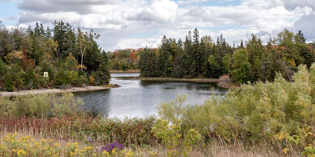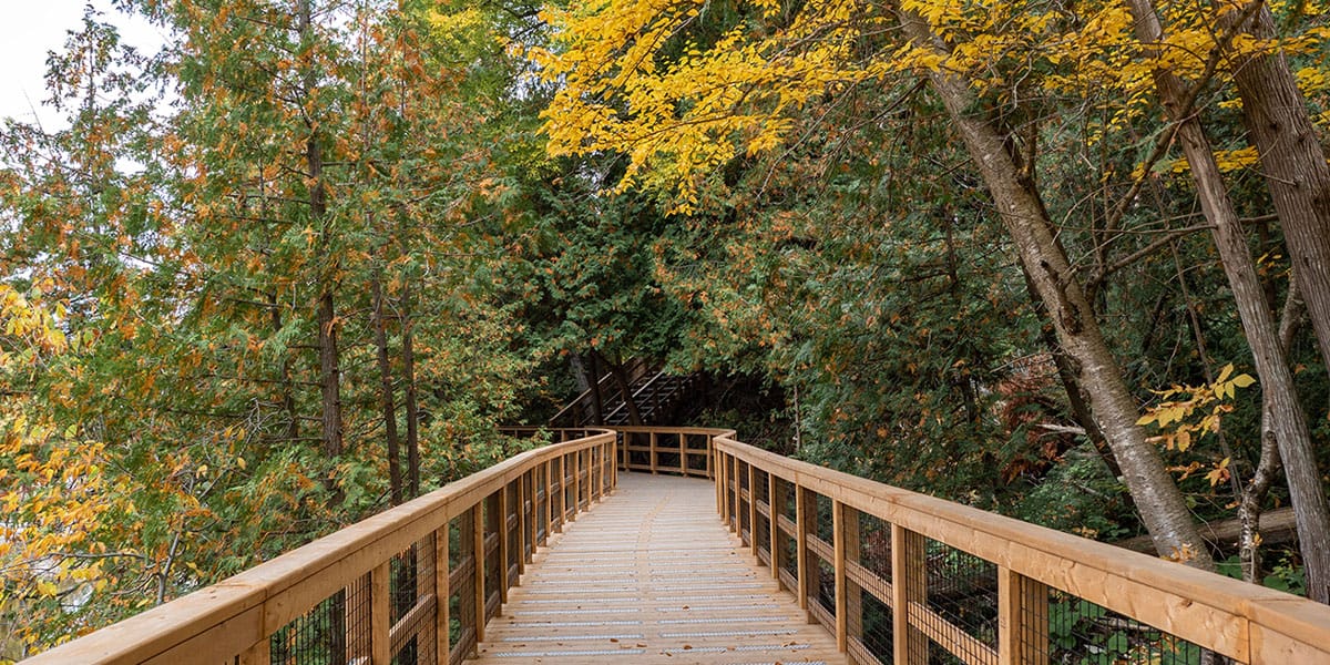
Splitrock Narrows Nature Reserve has memorable hiking trails that are part of the impressive Bruce Trail, a long distance hiking trail in southern Ontario from Niagara to Tobermory. Located near the towns of Shelburne and Mono, Splitrock Narrows isn't too far from the wildly popular Mono Cliffs Provincial Park.
However, the hiking experience at Splitrock Narrows is much quieter than what you'll find at Mono Cliffs, despite it only being a couple of kilometres down the road. There is a separate parking lot for Splitrock Narrows (it's free!) and you can hike to Mono Cliffs if you're looking to extend your hike. If you are looking to get out into nature for an hour or so, Splitrock Narrows has so much to offer. It's one of the best places to go hiking near Orangeville, too.
Join the Ontario Hiking Facebook Group
You are also welcome to join our Ontario Hiking Facebook Group - it's a great way to ask questions about hiking in Ontario, share your Ontario hikes, and get inspired!
Come Hiking With Us! Join an Upcoming Group Hike or Tour!
We are so excited to have group hiking adventures within Ontario and beyond. Learn more about how you can join us for a group hiking trip.

Splitrock Narrows Nature Reserve Map

Here is a map of the hiking trails at Split Rock Narrows Nature Reserve. While you won't find the main Bruce Trail at this park, you will find several of its side trails marked by blue blazes. The trails form one main loop, as well as the short dead-end Narrows Side Trail. In total, the hike at Splitrock Narrows is approximately 4km, and you can expect to spend about an hour here.
Hiking at Splitrock Narrows

It's such a wonderful privilege to be able to hike at Splitrock Narrows Nature Reserve. This protected greenspace, owned by the Bruce Trail Conservancy, is home to a very unique geological phenomenon. Initially, you'll stumble upon forests and farmer's fields. Beyond that, there are rocky outliers, a glacial spillway, steep cliffs, expansive views, and an intriguing crevice system for which Splitrock Narrows is named.


In total, the loop at Splitrock Narrows is approximately 4km in length if you follow the Splitrock Side Trail in its entirety, the Ralph Tremills Side Trail, and then retracing your steps back on the Splitrock Side Trail (making a detour onto the Narrows Side Trail at the end).
Splitrock Side Trail

The Splitrock Side Trail is 1.9km from the parking lot to the point where it splits into the Ralph Tremills Side Trail and the 2nd Line EHS Side Trail. It forms a loop with the Ralph Tremills Side Trail within the park boundaries.


Follow the blue blazes of the Splitrock Side Trail from the parking lot. Once you walk past some expansive meadows and fields, you'll make a slight ascent up into the forest. You'll notice your first moss covered crevice system on the way, which is just a glimpse into what's to come on this beautiful hike.


At this point, you can explore the Narrows Side Trail, though I continued on the Splitrock Side Trail, leaving the Narrows Side Trail for the end (saving one of the best parts of the park for last!). You'll also come across a spot where the trail splits. Keep hiking on the Splitrock Side Trail and you'll hike back on the Ralph Tremills Side Trail.


Along the way, you'll come across many more caves and crevices alongside the trail. Although they are too narrow to climb into, you can peer into these cracks, fissures, and crevice caves. The rock formations are really interesting and similar to others that you may find along the Niagara Escarpment (Mount Nemo Conservation Area and Limehouse Conservation Area come to mind).


Hanna & Pieter's Woods is a section of forested property on the Splitrock Side Trail. You'll find mature Sugar Maple, American Beech, White Birch, Black Cherry, and massive Butternut trees here. Butternut trees are an endangered species in Ontario.


There are also Twisted Eastern White Cedar trees here that are possibly more than 1000 years old. These cling to the weathered rock face at the edge of the escarpment. This wondrous forest property provides sanctuary to provincially and naturally rare birds, like the Eastern Wood-Pewee and Wood Thrush.
2nd Line EHS Side Trail

The 2nd Line EHS Side Trail (1.3km) isn't really part of Splitrock Narrows. It's a side trail that leads you out of the park. The path follows the dirt road, 2nd Line EHS, and connects with the Walter Tovell Side Trail into Mono Cliffs Provincial Park. If you'd like to continue your hike and explore Mono Cliffs, follow the 2nd Line EHS Side Trail to the Walter Tovell Side Trail.
Ralph Tremills Side Trail

To make a loop back to the Splitrock Side Trail, hike on the Ralph Tremills Side Trail (960 metres). While there aren't many crevices on this route, you will hike through a pretty and peaceful forest on your return towards the Splitrock Side Trail and the Narrows Side Trail.
Narrows Side Trail

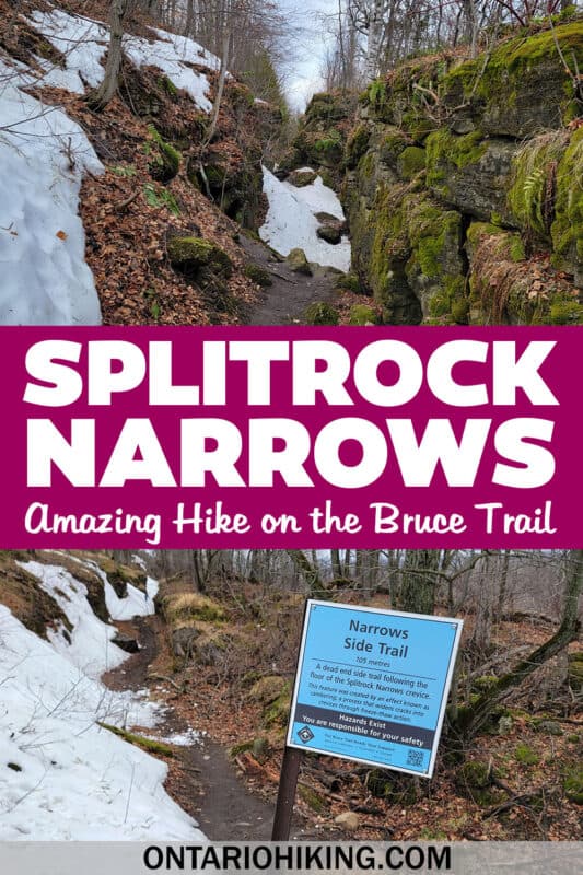
The Narrows Side Trail is a short, dead-end trail where you'll follow the floor of the Splitrock Narrows Crevice for which the park was named. This crevice was created by an effect known as cambering. Cambering is a process in which a crack becomes widened into a crevice through freeze-thaw action.


The rock walls here are covered in a thick moss. Walk between the rocks until you reach the end of the path. Then, you'll need to turn around and walk back to where you started. You may also find 420 million year old crinoid fossils along the walls of the crevice.
Want to see more photos from Splitrock Narrows?
Browse our entire travel photography album in one place. You can browse and buy any of our pictures, including prints, gifts and more.
Plan Your Visit to Splitrock Narrows
Splitrock Narrows Nature Reserve is a loop hike on a series of Bruce Trail side trails. There is a parking lot that's large enough to fit several cars. You'll find the parking lot on 2nd Line EHS, just beyond the park boundaries for Mono Cliffs Provincial Park.

While it is free to visit, park and hike at Splitrock Narrows Nature Reserve, please note that there aren't any facilities here. There isn't a restroom. You're purely out in nature here. If you are looking for a restroom, as well as a place to stop for food and coffee, I recommend driving into the town of Shelburne. You can stop at Super Burger to use the bathrooms, grab some fast food (love their veggie burgers) and some coffee (Super Coffee, to the rescue!).
What to Bring on a Hike
A proper pair of hiking shoes is an absolute must. It’s also a good idea to bring sunscreen and lots of water, too. My water bottle of choice is the GRAYL Purifier because you can drink ANY water from any source, no matter what. Water from lakes, streams, rivers, public restrooms, you name it. It's the world's fastest portable purifier.
Don’t forget to pack some bug spray because there can be biting bugs depending on the time of year. Even if there aren't any signs, it’s safe to assume that ticks are all over Ontario hiking trails. Protect yourself against ticks by reading our guide to avoiding ticks on the trails.
For amazing deals on hiking products like backpacks, boots, clothing, and gear, check out the Decathlon Canada shop!
More Hikes in York Durham Headwaters Region
Looking for more hikes in the area? Here are all of our hiking guides for York Durham Headwaters region:
- Belfountain Conservation Area
- Boyne Valley Provincial Park
- Mono Cliffs Provincial Park
- Cheltenham Badlands
- Hockley Valley Provincial Park
- Forks of the Credit Provincial Park
- Island Lake Conservation Area
- Nokiidaa Trail
- Thornton Bales Conservation Area
- Greenwood Conservation Area
- Cold Creek Conservation Area
- Happy Valley Forest
| Follow Ontario Hiking on Social Media! Instagram | Facebook | Twitter | Pinterest | Newsletter | Join the Community |


Become an Ontario Hiking Supporter!
Join the Ontario Hiking Patreon and you'll become a VIP member of the Ontario Hiking community! You'll receive ad-free, downloadable hiking guides with new guides added weekly. Plus, there are many more perks! Become an Ontario Hiking Supporter today!


Check out the Ontario Hiking Shop!
Inspired by adventures and nature. Ontario hiking and Bruce Trail apparel & accessories, designed by me.