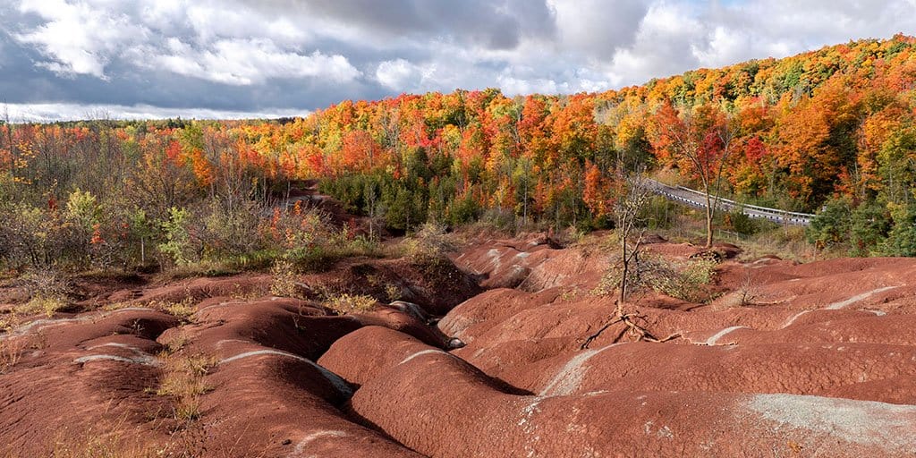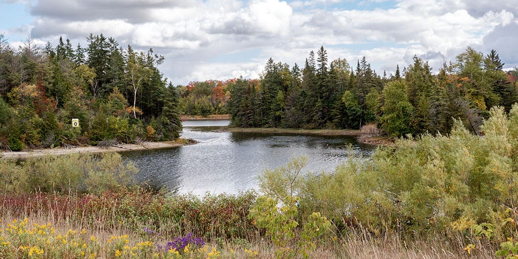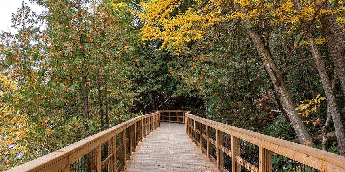
Mono Cliffs Provincial Park is one of the most popular parks in southern Ontario. It's a beautiful park that's not too far from Toronto, Mississauga, and Brampton. It's one of the best places to go hiking near Orangeville, too. There are a variety of trails and landscapes, including impressive cliffs, intriguing staircases, and gorgeous lookouts. Plus, the Bruce Trail runs through the provincial park, so you know it has to be a good one!
In this hiking guide, I'm going to show you all of the best places to go hiking at Mono Cliffs Provincial Park. I'll include details about each trail and how you can plan your day there. I'd give yourself about three hours to properly explore the park, although you could spend more or less time there. It could take up to 4 to 5 hours to walk every trail, or you could hike for 1 to 2 hours to see the highlights.
Please note that you currently require a reservation to visit Mono Cliffs Provincial Park. It's easy to book a reservation. I go over all of the details under the "Plan Your Visit" section of this blog post a little further down the page. If in doubt, it's always a good idea to check the park's official Twitter account for the latest updates on capacity.
Join the Ontario Hiking Facebook Group
You are also welcome to join our Ontario Hiking Facebook Group - it's a great way to ask questions about hiking in Ontario, share your Ontario hikes, and get inspired!
Come Hiking With Us! Join an Upcoming Group Hike or Tour!
We are so excited to have group hiking adventures within Ontario and beyond. Learn more about how you can join us for a group hiking trip.
Mono Cliffs Provincial Park Trail Map

Here is a trail map for Mono Cliffs Provincial Park. You'll see the map posted at the parking lot, as well as several other places on the way (mostly at trailheads). It's easy to get an idea of where you are and where you should go.
The trails are also well marked. Feel free to reference this map as you hike or take a photo of one in the park to check out. Mono Cliffs has 19km of trails to explore, including the following:
- Carriage Trail (1.3km)
- Cliff-Top Side Trail (2.8km)
- Lookout Trail (600m)
- McCarston's Lake Trail (3.6km)
- South Outlier Trail (3.5km)
- Spillway Trail (1.3km)
- Walter Tovell Trail (4.8km)
- And the Bruce Trail (which ventures through parts of the South Outlier Trail, Walter Tovell Trail, Cliff-Top Side Trail and McCarston's Lake Trail)
Hiking at Mono Cliffs Provincial Park

Mono Cliffs Provincial Park is on the Niagara Escarpment, a UNESCO World Biosphere Reserve. The Niagara Escarpment runs from Niagara Falls right up through Georgian Bay. It's a very special place in the world, naturally and ecologically. There are numerous forests, cliffs, and wetlands that are home to hundreds of species of birds, fish, animals, reptiles and amphibians.
The Niagara Escarpment formed over millions of years through weather and the erosion of its rocks. There are harder rock layers above (dolomite and limestone), and softer rocks underneath that became eroded and weathered. To the north and south of Mono Cliffs, the Niagara Escarpment lies buried beneath thick deposits of rock, sand and gravel that were dumped by the glacier.
Mono Cliffs is a unique place where you'll be able to walk between the rocky cliffs of the Niagara Escarpment, towering 30 feet overhead. Massive ice chunks also created McCarston's Lake, which is a kettle lake. You'll also be able to discover one of the largest concentration of fern species in Ontario (44 in total!), including the rare Hart’s-tongue Fern.
Carriage Trail

From the main parking lot, you'll start hiking on the Carriage Trail. It's the red trail on the trail map. For the most part, you'll walk through shady forests and across one expansive meadow.


There are handwritten signs at this point that read, "viewing platform". I suggest following those signs on your first visit to the park. This will lead you straight to the lookout platform and the most iconic spot where you can walk between the cliffs.

By using this method, you'll take the Carriage Trail to the Spillway Trail. Head north on the Spillway Trail which connects to a small portion of the Walter Tovell Trail.


Then, you'll walk up an incline to the viewing platform. Nearby, there's a staircase that descends to the rock formations.
Cliff-Top Side Trail

At the northern edge of the Cliff-Top Side Trail, you'll encounter a staircase. Walk down the stairs to a wooden boardwalk that meanders between looming cliffs. It's only a short walk between the towering rock formations, but it's a really interesting spot in the park that isn't to be missed.


After a short walk, you'll reach a dead end on the boardwalk, so you'll need to turn around and walk back up the stairs. Next, you'll reach the viewing platform. This lookout offers some pretty beautiful views of your surroundings. This looks especially brilliant in the fall.


Continue south on the Cliff-Top Side Trail (which is also part of the Bruce Trail). You can keep going to the end of the trail, which forms a loop with the Walter Tovell Trail.


I decided to connect back with the Carriage Trail, where there's another large wooden staircase that descends into the forest.
South Outlier Trail

After I saw the main sights along the Cliff-Top Side Trail, I ventured back on the Carriage Trail towards the parking lot until I connected with the South Outlier Trail. This is a loop marked in yellow on the trail map. Don't miss the South Outlier Trail, especially the western side of the trail that follows the edge of the cliffs. It was one of my favourite areas of the park.


It's a bit of a trek up the hill at the start of the South Outlier Trail. I didn't mind hiking up the edge of the hill as it looked a little trickier to hike down it. Once you reach the top, it's a relatively flat path. I didn't see anyone else on the trail when I was there. The fall foliage here was outstanding with many red and orange leaves on the trees.


There's another unofficial lookout point on the South Outlier Trail that faces the cliffs on the opposite side (near the Cliff-Top Trail). I think that I enjoyed this lookout point even more than the one on the official viewing platform. You could see the treetops right up to the edge of the cliff, and the rock formations add an extra element to the view.
Walter Tovell Trail

After hiking to the most southern point of the South Outlier Trail, I connected with the Walter Tovell Trail (marked in blue on the map). Then, I walked north to the Spillway Trail. The Walter Tovell Trail is a wide, flat path that's great for beginner hikers.


In fact, most of the trails at Mono Cliffs Provincial Park are fantastic for beginner and experienced hikers alike. Mono Cliffs is kid-friendly and dog-friendly, too!
Spillway Trail
I mentioned hiking on the northern section of the Spillway Trail at the start of my hike. From the Walter Tovell Trail, I hiked the remaining southern portion of the Spillway Trail. It isn't a really interesting path, but it helps you get from one point to the next.
McCarston's Lake Trail

McCarston's Lake Trail is an additional loop trail connected to the Cliff-Top Side Trail. I didn't hike this one when I was there, but it's easy to add it onto your trek. You can see McCarston's Lake, a kettle lake, on your journey. You can choose to do the full loop of the McCarston's Lake Trail or connect to the Lookout Trail.
Lookout Trail
The Lookout Trail is one of the more popular places to visit at Mono Cliffs Provincial Park, but I actually missed doing this one, too. You can't go wrong with seeing another lookout at this beautiful place. Be sure to check it out while you're there and let me know what you think!
Want to see more photos from the Mono Cliffs?
Browse our entire travel photography album in one place. You can browse and buy any of our pictures, including prints, gifts and more.
Plan Your Visit to Mono Cliffs Provincial Park
Mono Cliffs Provincial Park is a non-operating provincial park, meaning that you're not able to camp overnight, it isn't staffed, and there aren't any facilities. There is a large parking lot at the entrance of Mono Cliffs Provincial Park, and you'll need to pay a day rate from one of the machines at the parking lot. This covers your parking fees and your entry fees to the park.

Since 2021, Mono Cliffs Provincial Park is one of the most popular parks that requires a reservation in advance. You can reserve a day permit at these parks up to five days in advance at the Ontario Parks website. Navigate to "day use" and select the park of your choice. Pay the fee online and you're good to go.
I suggest picking up an Ontario Parks annual pass if you're going to be visiting more than a few parks in a year. It provides the greatest value if you plan to visit five or more parks in a year. An Ontario Parks pass allows you to use the parks all day for free, including parking and spending the day at the parks. It also allows everyone in your car with you to gain entry as well, and you can use it in any vehicle (just bring your pass to display in your car).

Mono Cliffs Provincial Park has washrooms at the main parking lot, and there are other restrooms along the trails, too. The trail maps posted at the parking lot and at several trailheads on the way show where you can find the restrooms. It will also tell you which trails are suitable for hiking, biking, and horseback riding.
What to Bring on a Hike
A proper pair of hiking shoes is an absolute must. It’s also a good idea to bring sunscreen and lots of water, too. My water bottle of choice is the GRAYL Purifier because you can drink ANY water from any source, no matter what. Water from lakes, streams, rivers, public restrooms, you name it. It's the world's fastest portable purifier.
Don’t forget to pack some bug spray because there can be biting bugs depending on the time of year. Even if there aren't any signs, it’s safe to assume that ticks are all over Ontario hiking trails. Protect yourself against ticks by reading our guide to avoiding ticks on the trails.
For amazing deals on hiking products like backpacks, boots, clothing, and gear, check out the Decathlon Canada shop!
Where to Stay Near Mono Cliffs Provincial Park
Thinking about making a little vacation or overnight stay of it? The beautiful Hockley Valley Resort is near Mono Cliffs Provincial Park. You’ll be surrounded by many more hiking trails, a renowned golf course, a winery, restaurant, and so much more. Read more about how my boyfriend, Justin and I enjoyed a memorable overnight stay at Hockley Valley Resort.
More Hikes in York Durham Headwaters
Looking for more hikes near Mono Cliffs Provincial Park? This region has tons of provincial parks, conservation areas, and hiking trails that you'll love. It's really a beautiful area of Ontario and I recommend exploring as many of these places as possible:
- Boyne Valley Provincial Park
- Hockley Valley Provincial Nature Reserve
- Island Lake Conservation Area
- Thornton Bales Conservation Area and Jokers Hill
- Cold Creek Conservation Area
- Happy Valley Forest & Humber Source Woods
- Nokiidaa Trail (Holland River Trail)
If the parking lot at Mono Cliffs Provincial Park is full, I suggest driving to nearby Boyne Valley Provincial Park, Hockley Valley Provincial Park, or Island Lake Conservation Area. All three are wonderful and the perfect alternatives to Mono Cliffs. Whatever you do, don't park on the roadways surrounding Mono Cliffs Provincial Park - you could get a hefty ticket or even towed.
This trail is featured in our list of the 100 best hiking trails in Ontario. Take a look at the entire list to plan all of your future hiking adventures!
| Follow Ontario Hiking on Social Media! Instagram | Facebook | Twitter | Pinterest | Newsletter | Join the Community |


Become an Ontario Hiking Supporter!
Join the Ontario Hiking Patreon and you'll become a VIP member of the Ontario Hiking community! You'll receive ad-free, downloadable hiking guides with new guides added weekly. Plus, there are many more perks! Become an Ontario Hiking Supporter today!

Check out the Ontario Hiking Shop!
Inspired by adventures and nature. Ontario hiking and Bruce Trail apparel & accessories, designed by me.