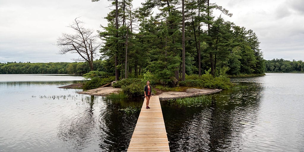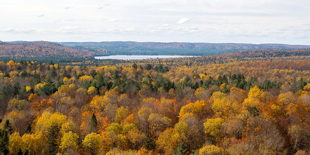
Limberlost Forest and Wildlife Reserve offers some of the best hiking trails in Muskoka. While most hikers tend to flock to the more popular parks like Arrowhead Provincial Park and Algonquin Provincial Park, Limberlost Forest is a hidden gem frequented mostly by locals. After seeing so many recommendations from hikers in the Ontario Hiking Facebook group, I knew that I had to check it out for myself.
Limberlost Forest is a privately owned wilderness property that's accessible to the public. There are twenty lakes and 10,000 acres of forest with trails to wander and explore. In total, there are 70km of trails for hiking, biking, skiing and snowshoeing. There's also a disc golf course on the property. And best of all, it's free for the public to visit.
There are rental cottages and campsites at Limberlost Forest where those fees pay for the maintenance of the property. They also make it possible for any day hikers or visitors to check out the wildlife reserve at no charge.
Join the Ontario Hiking Facebook Group
You are also welcome to join our Ontario Hiking Facebook Group - it's a great way to ask questions about hiking in Ontario, share your Ontario hikes, and get inspired!
Come Hiking With Us! Join an Upcoming Group Hike or Tour!
We are so excited to have group hiking adventures within Ontario and beyond. Learn more about how you can join us for a group hiking trip.

Limberlost Forest and Wildlife Reserve Map
Here is a trail map from the Limberlost Forest and Wildlife Reserve website. There are 70km of trails here. The dotted green lines denote trails, and the dotted orange lines mark unrestored trails.

If you'd like to view a complete map of the trails, campsites, and more, please take a look at this detailed Google map created by Limberlost Forest. Here is a listing of the main trails at Limberlost:
- Solitaire Trail (6.3km)
- Buck Lake Trail (4.3km)
- High Lake Trail (2.1km)
- Hickory Lake Trail (2.3km)
- Turtle Lake Trail (4.7km)
- Kalonga Wetland Trail (5.8km)
- Ski Hill Trail (1.3km)
- Echo Rock Trail (1.6km)
Limberlost Forest Trails

Limberlost Forest and Wildlife Reserve offers 70km of trails, so you can visit again and again for new experiences each time. As I've only visited Limberlost Forest once, I only had the chance to explore one trail. However, when I return, I'll update this article with more trail guides for each path.
Please note that the official Limberlost Forest website lists the distances of the hiking trails at nearly double their actual length. For instance, I hiked the Solitaire Trail, which was listed as a 13km trail but actually was about 6.3km in total. I've listed the lengths of each trail above according to AllTrails and not their official website, although the official website offers many more trail facts and details than AllTrails ever could.
Solitaire Trail

When I visited Limberlost Forest, I hiked the Solitaire Trail. It is rated as easy to moderate. The trail forms a loop around Solitaire Lake, and it is just over 6km in length. It took me 2 hours to hike the entire trail, though I am a slightly slower hiker and I stop a lot to take photos.


From the main parking lot, you'll follow the yellow signs towards the Solitaire Trail. From there, the trail is very well marked with either similar yellow signs or red trail blazes. There's really only one trail the entire time, so it's difficult to get lost. I walked in a clockwise direction around the lake.


There are many interesting features on the Solitaire Trail. First, you'll hike past some small sandy beaches and cottages perched on the lake. The cottages are private property, including their docks and deck chairs, so be sure to keep hiking along the trail without stopping. The trail winds through the forest and past marshy areas, too.


The Hidden Cliffs Boardwalk is one of the most intriguing features on the Solitaire Trail. First, you'll cross a boardwalk as you approach the Hidden Cliffs, and then you'll walk beneath a massive rock overhang.


Next, you'll make the ascent to Echo Rock. There's a large quartz outcrop on the way to Echo Rock where you'll see an unusually large amount of quartz for this region. Then, you'll reach Echo Rock Lookout where you can admire this beautiful, deep blue lake from high up above.


You'll descend back down the trail from Echo Rock and eventually you'll be back on a flat path. There's another wooden boardwalk along the way. You will connect with the main road that you drive on when you enter the park that leads to the main parking lot.
Plan Your Visit to Limberlost Forest

Limberlost Forest and Wildlife Reserve is open daily from 9:00am to 5:00pm. There aren't any public washrooms available, there aren't any picnic areas, and there aren't any garbage cans. Please pack out what you bring in, especially if it's any dog waste or packaging.

It is extremely important to note that you must fill out Limberlost Forest's safety waiver before you visit. You can also fill it out at their day use office upon arrival. You cannot go hiking at Limberlost Forest without completing the safety waiver, and it is your responsibility to do so.
Limberlost Forest is free to visit. If you haven't filled out the safety waiver or you visit outside of the operating hours, you can risk having your car towed. Please abide by all of the rules and you'll be fine!

What to Bring on a Hike
A proper pair of hiking shoes is an absolute must. It’s also a good idea to bring sunscreen and lots of water, too. My water bottle of choice is the GRAYL Purifier because you can drink ANY water from any source, no matter what. Water from lakes, streams, rivers, public restrooms, you name it. It's the world's fastest portable purifier.
Don’t forget to pack some bug spray because there can be biting bugs depending on the time of year. Even if there aren't any signs, it’s safe to assume that ticks are all over Ontario hiking trails. Protect yourself against ticks by reading our guide to avoiding ticks on the trails.
For amazing deals on hiking products like backpacks, boots, clothing, and gear, check out the Decathlon Canada shop!
More Hiking in Muskoka
Looking for more places to go hiking in the Muskoka/Algonquin area? Here are more trails that you’ll love:
- Arrowhead Provincial Park (Huntsville)
- Beausoleil Island (Georgian Bay Islands National Park)
- Hardy Lake Provincial Park (Gravenhurst)
- Oxtongue River-Ragged Falls Provincial Park
- The Best Hiking Trails at Algonquin Park
- Booth’s Rock Trail at Algonquin Provincial Park
- Lookout Trail at Algonquin Provincial Park
- Spruce Bog Boardwalk Trail at Algonquin Provincial Park
This park is featured in our list of the 100 best hiking trails in Ontario. Take a look at the entire list to plan all of your future hiking adventures!
| Follow Ontario Hiking on Social Media! Instagram | Facebook | Twitter | Pinterest | Newsletter | Join the Community |


Become an Ontario Hiking Supporter!
Join the Ontario Hiking Patreon and you'll become a VIP member of the Ontario Hiking community! You'll receive ad-free, downloadable hiking guides with new guides added weekly. Plus, there are many more perks! Become an Ontario Hiking Supporter today!

Check out the Ontario Hiking Shop!
Inspired by adventures and nature. Ontario hiking and Bruce Trail apparel & accessories, designed by me.